Why a Route Looks Different at Running Pace
Learn to read a running route at pace by spotting bends, landmarks and surface changes, so you can anticipate turns and choose where to focus.
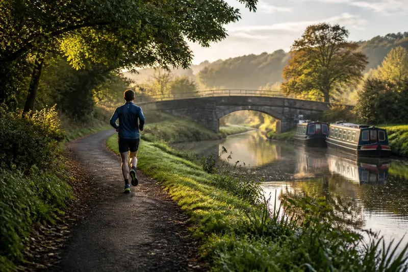
A footpath beside a canal looks like one unbroken strip on a map, but running along it reveals a shaded bend, a stretch of gravel and a bridge that appears as the path rises. Reading a running route as a sequence of short segments makes those changes easier to anticipate and gives each stretch a clear purpose.
This is not about dividing a run into formal training intervals. It is a way to notice what the route is doing beneath your feet and ahead of you, so that a long line on a screen becomes a chain of readable places.
A bend is a decision point, not just a curve
On a map, a bend is a change in direction. From the path, it is also a change in what you can see. A tight turn may hide a crossing, a dog walker or a change in surface; a broad curve may reveal the next landmark gradually. The difference matters because your view arrives in pieces as you move.
Before a blind corner, shift your attention from the distant route to the ground immediately ahead. Leave room to adjust your line if someone is coming the other way. On a wide, open curve, you can look through the bend towards the next visible feature instead of treating the turn as an endpoint.
Notice what a bend does to the route’s rhythm, too. A sharp turn on a narrow park path may call for a brief easing of pace, while a gentle sweep along a broad riverside trail may require little change. The shape alone does not dictate your response: sightlines, other path users and footing all contribute.
Landmarks work best in a sequence
A useful landmark is something you can recognise from the path: a footbridge, a distinctive gate, a line of trees, a playground entrance or a fork beside a bench. It should help answer a simple question: what comes next? A long route becomes easier to hold in mind when these features form a loose sequence rather than a list of distant place names.
Choose landmarks visible from your direction of travel. A building tucked behind trees may be obvious on a map yet useless as a running cue. A painted trail marker or a bridge rail may be less prominent from above but much easier to spot on approach.
At junctions, pair the landmark with the action you need to take. “Turn left at the wooden bridge” is clearer than “turn left somewhere after the open field”, especially if several paths cross the field. If you are using a phone, check the route while stopped in a safe place rather than looking down as you run.
Say you are planning an invented loop through a local park. You mark the entrance gate, a fork beside a pond and a footbridge as three cues, then note that the path after the bridge narrows. The expected result is a route you can recall as a simple sequence—gate, pond fork, bridge, narrow path—rather than a line you must keep checking on a screen.
Surface changes tell you what kind of attention to use
Surfaces can change within a short stretch: smooth paving meets packed dirt, then loose gravel or damp leaves. A map may show all of it as one route, but your feet receive different information from each part. Treat the transition as a small segment of its own, particularly where the new surface begins near a corner, slope or crossing.
Look for clues before you reach the change. A pale strip at the edge of a path might be loose stone; a dark patch beneath trees may be wet after rain. These clues are not certainties, but they can prompt you to shorten your stride or choose a firmer line while you assess the ground.
- Paved paths: Check for raised edges, drain covers and busy crossings. If they interrupt your line, slow or choose a clear path around them; otherwise, continue watching the surface ahead.
- Gravel: Notice whether it is packed or loose. If it shifts underfoot, avoid sudden turns and use a firmer edge if one is clear; if it feels settled, keep scanning for changes.
- Grass and dirt: Look for ruts, roots and soft patches, especially beneath trees. If the ground is uneven, pick a clear line or ease your pace; if it is firm and visible, continue with ordinary attention.
- Leaves or wet ground: Check for concealed edges and smooth-looking patches. If footing is uncertain, shorten your stride or use a clearer route; if the surface looks firm, still watch for hidden changes.
The aim is not to inspect every step. It is to recognise where the character of the ground changes, then let that information shape your attention for the next short stretch.
What should you notice between landmarks?
Between named landmarks, look for details that change how you should read the next stretch: a narrowing path, a hidden crossing, a slope, a change in surface or a place where sightlines open or close. These features help you decide whether to keep a steady line, look more closely at the ground, or prepare to slow and choose a direction.
Say you are following an invented route from a park gate towards a footbridge. The path is paved at the gate, then narrows beside a hedge; a side path appears before the bridge, and the paving gives way to gravel. You note those observations in order and decide to keep right at the side path, check the gravel underfoot and ease your pace if it is loose. The expected result is a clear sequence of actions even though no named landmark marks the hedge or surface change.
How long is a useful route segment?
There is no fixed length. A segment can run from one gate to a junction, from a bridge to a surface change, or simply through a stretch with a clear sightline. Choose boundaries that make sense on the ground, not arbitrary distances.
Should you memorise every turn?
For a familiar route, remember the junctions where a wrong turn is plausible and the landmarks that confirm you are on track. For a new route, keep navigation available, but check it only when you are safely stopped or walking.
What if a landmark is missing or hard to see?
Use a second cue, such as the path’s direction, a nearby crossing or a recognisable feature beyond the junction. If both cues are unclear, pause somewhere out of the way and confirm your position rather than guessing at a turn.
How can you read a route in poor light?
Give more weight to obvious path features, such as a lit entrance or bridge, and less to details that disappear in shadow. A route that depends on subtle signs or uneven ground may be easier to save for daylight.
Keep route notes brief and observable
After a run, jot down only details that could help you recognise the route next time: “gravel starts beyond the low stone wall”, “fork after the pond”, or “narrow path has a blind bend”. These are more useful than broad impressions such as “mostly easy” because they point to a visible location and a practical choice.
A basic map app can help you trace the route, while a paper note or a saved phone note can hold the landmarks in order. If a path is confusing, add a plain directional cue—such as “keep the fenced field on the right”—but avoid relying on temporary features that may change.
Keep the notes flexible. A parked maintenance vehicle, a crowded picnic area or a temporary barrier can alter what you see on a particular day. Use permanent features to orient yourself and treat passing activity as information about conditions, not as a fixed part of the route.
Let the route set the size of each decision
Some stretches need little attention: a straight, open path with a clear surface can be read at a glance. Others deserve a closer look: a blind bend, a busy junction, a muddy descent or a place where walkers share a narrow track. Segmenting the route lets you give each place the attention it calls for without treating the whole run as a navigation problem.
When you plan a route, ask not only where it goes, but what you will see as you move through it. A bridge, a bend and a change from paving to dirt can turn a vague line into a sequence of understandable choices. The map shows the connection; the moving view reveals what each part asks you to notice.